
Hiking · Cycling · MTB
Roam. Edit. Store. Share. Come back safe.
Trackisi is the GPS app for hiking, cycling and mountain biking: IGN and satellite maps, a route editor for trails and mountains, cloud storage for your tracks and photos, a travel journal to share — and a virtual guardian watching over you, even offline.
Android & iPhone · Google Play & App Store · Free
All-in-one
One app, your whole adventure
From planning on the sofa to arriving home — Trackisi is with you every step of the way, on the ground and before you set off.
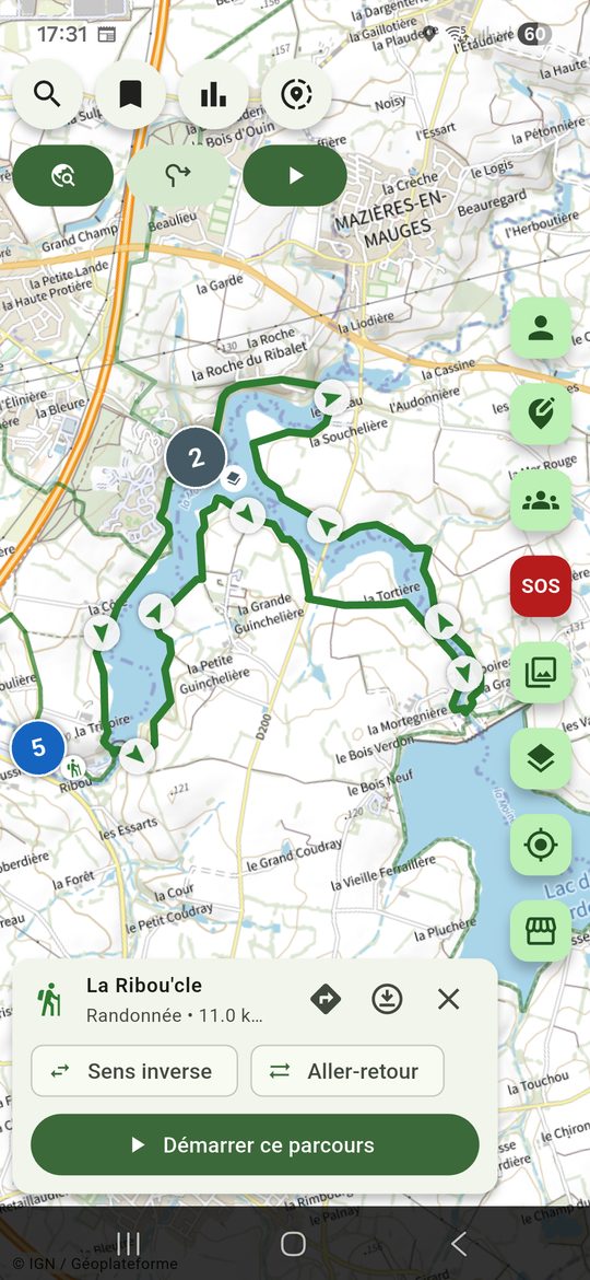
Maps & offline
IGN, satellite, topo — download areas and navigate offline.
Create a route
Map editor, trail snapping, elevation profile, web editor.
Guided navigation
Directional guidance, voice alerts, off-route detection.
Loop generator
A custom loop based on your target distance and elevation.
Weather & wind
Forecast along the route, wind, sunrise/sunset, live alerts.
Community routes
Discover routes shared near you, filter and rate.
Travel journal
Group your outings into an illustrated journal, with optional AI-written text, shareable with a single link.
Cloud storage
Routes, photos and journals backed up automatically to the cloud — switch phones without losing anything.
Import & open GPX
Open an existing GPX file to follow or edit it.
Webcams
Check trail conditions before you leave, right from the app.
Virtual Guardian & SOS
Auto-alert contacts, call 112, distress SMS, medical card.
Live tracking
Your loved ones follow your position live — no app needed.
Group outings
Real-time positions for each member, shared route, group SOS.
Stats & history
Distance, D+, speed, map: every outing archived and reusable.
Expedition mode
Long, multi-day and off-grid outings. Advanced features coming.
Popular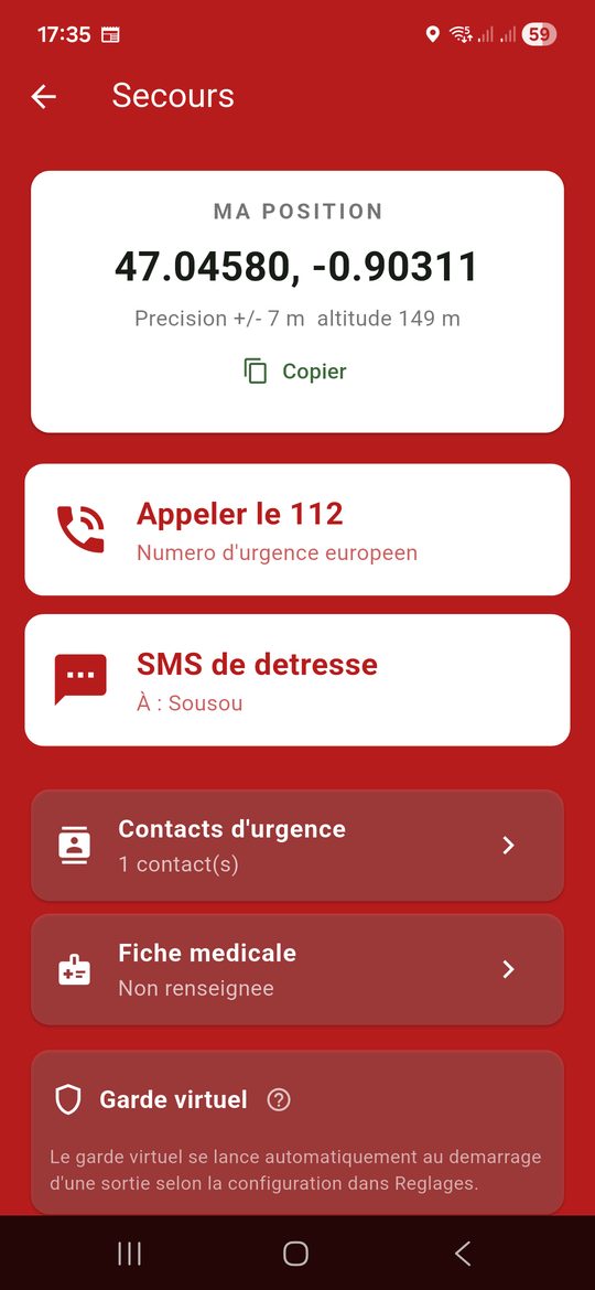
We've thought of everything
A virtual guardian watching over you
Nature is beautiful but unpredictable. Trackisi includes a comprehensive safety system so you can head out with peace of mind — and reassure your loved ones.
-
Virtual guardian
Starts automatically with every outing. If you're immobile or silent for too long, your trusted contacts are alerted by email with your last known position. -
SOS & 112
Precise GPS position, direct call to 112, pre-filled distress SMS and medical ID accessible in one tap. -
Live location sharing
Share your real-time tracking with loved ones for the duration of an outing. They see where you are, no app required. -
Built for offline use
Offline maps and background operation: the essentials keep working where 4G stops. -
Your data, protected
Your personal photos stay private by default, accessible only through a secure token-based link. Any content you share publicly is automatically checked before it goes live.
Frequently asked questions
Everything you need to know
What is Trackisi?
Trackisi (not "tracksino") is a French mobile app for hiking, cycling and mountain biking. It combines IGN and satellite maps, a trail and mountain route editor, offline guided GPS navigation, community routes, a travel journal and a virtual guardian that alerts your loved ones if something goes wrong. Free on Android and iPhone, with no account required.
Is Trackisi free?
Yes. All essential features — maps, routes, navigation, virtual guardian and SOS — are free. An optional Premium subscription will unlock advanced features and support the project.
Does the app work without a network?
Yes. You can download your map areas in advance and route recording continues in the background, even without 4G. The virtual guardian resumes as soon as signal returns.
How does the virtual guardian work?
During an outing, the app quietly sends signs of life. If you are immobile or silent for too long, your trusted contacts automatically receive an email with your last known position.
Is my location data protected?
Your data belongs to you. Location sharing is one-off and controlled by you, your personal photos are served through a protected token-based link, and you can delete your account and data at any time. See our privacy policy.
On which platforms is Trackisi available?
Trackisi is available on Android (Google Play) and on iPhone (App Store). A web version is planned.
Can I import existing GPX routes?
Yes. You can import a GPX file into the editor to follow, edit or share it with the community.
Ready to see the world bigger?
Join the adventurers who plan, explore and return safely with Trackisi.